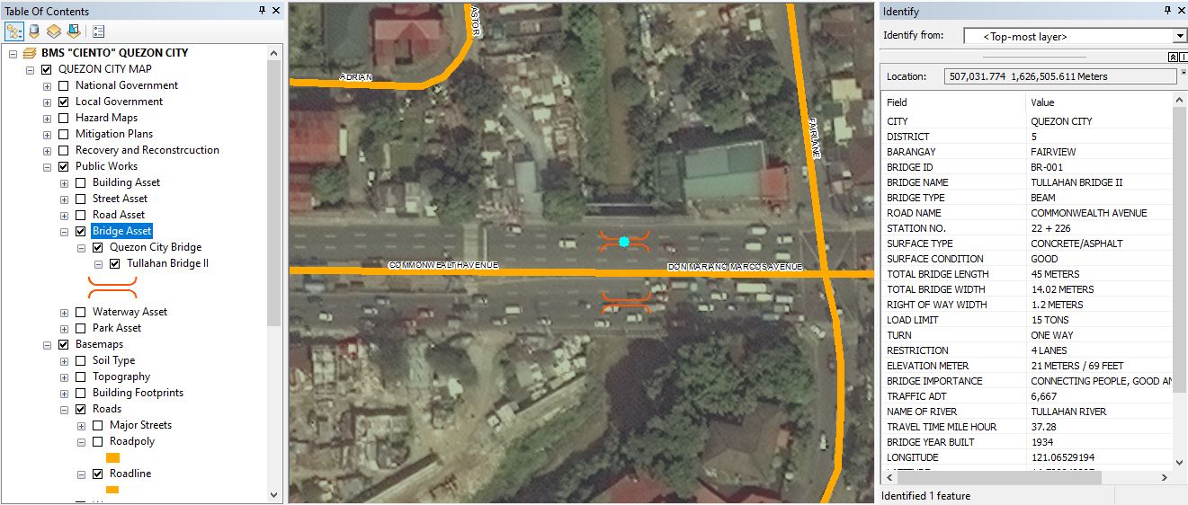
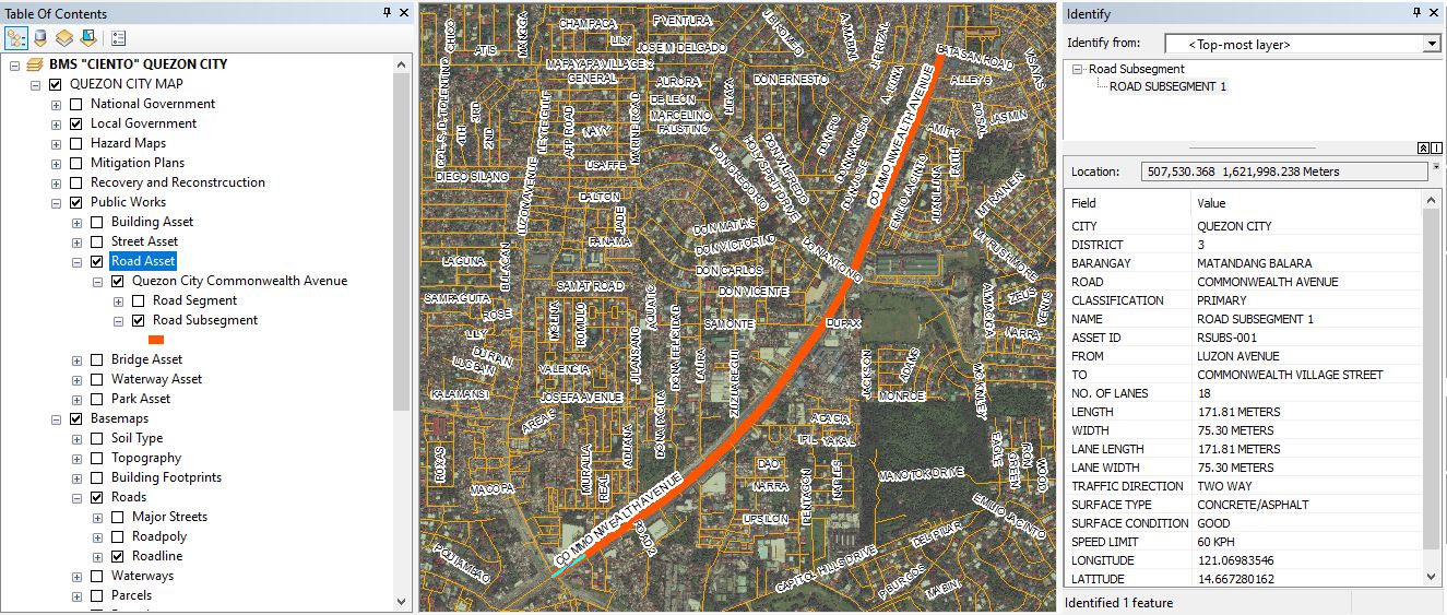
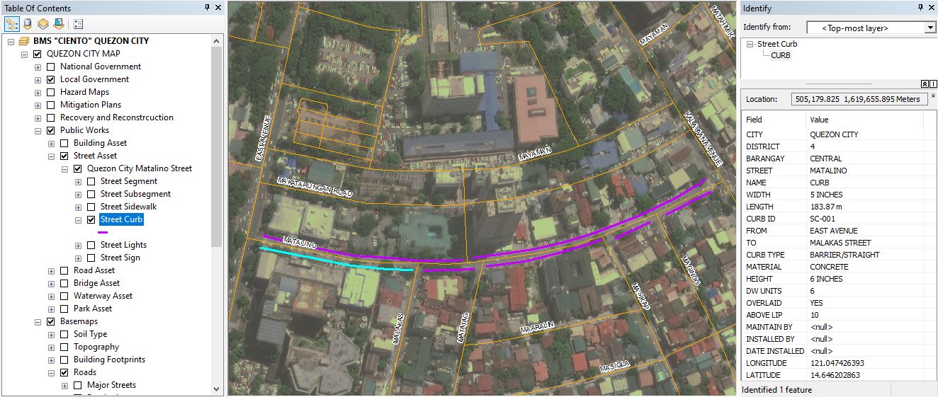
Mapping of Infrastructure Assets (Roads, Streets, ITS, Bridges, Ports, Airport, etc)
Location Mapping of different Infrastructure Assets which includes Roads, Streets, ITS, Bridges, and others. All the Details and Information of Infrastructure Assets can be viewed in the GIS Mapping.
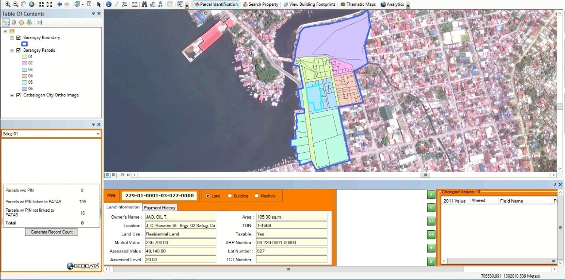
Mapping of Real Property Parcels
Location Mapping of all the Real Property Parcels which consists of the Land Information (Owner’s Name, Location, Land Use, Market Value, Assessed Value, Assessed Level, Area, TDN, and others).
Mapping of Buildings (By Classification)
Location of Private and Public Buildings can be easily mapped through GIS Location Mapping.
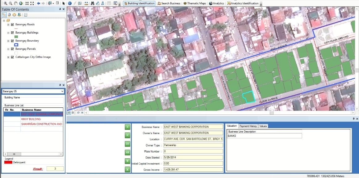
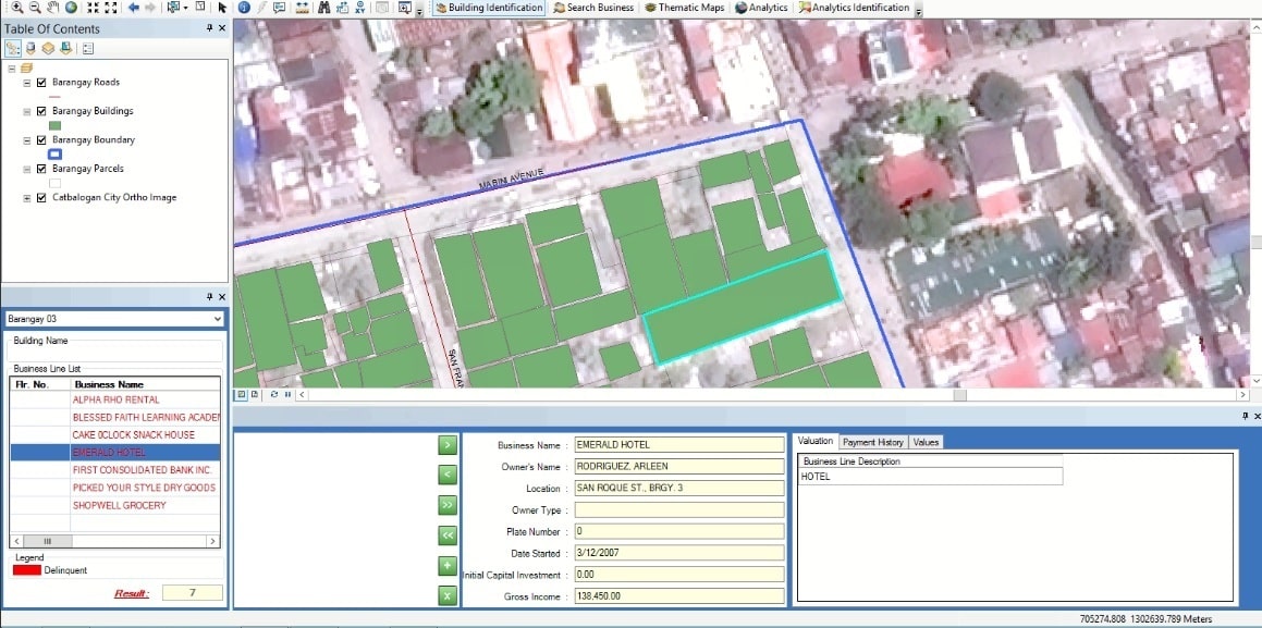
Mapping of Businesses
Location Mapping of Businesses in an area.
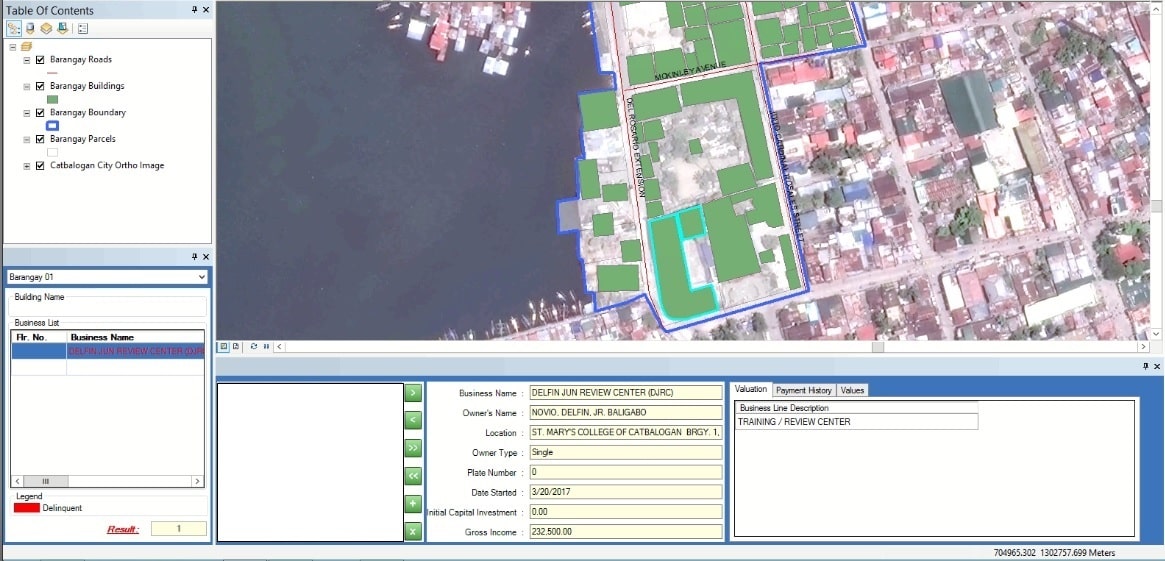
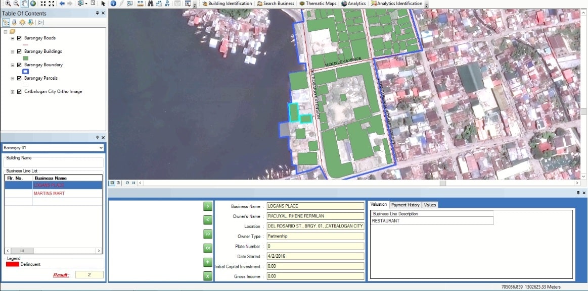
Mapping of Entertainment & Restaurants
Location Mapping of Entertainment & Restaurants with its Business Line Information.